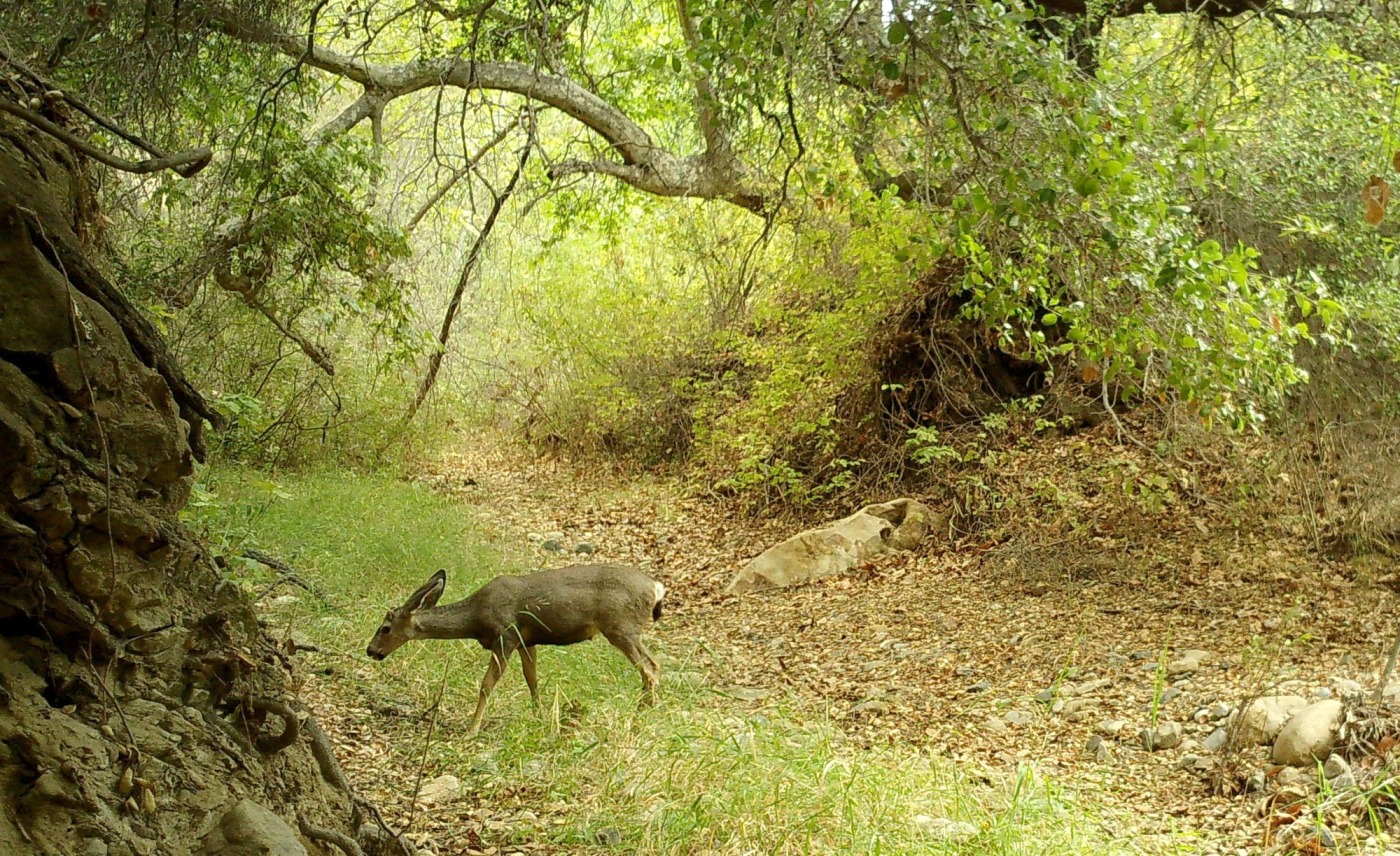
Newly implemented artificial intelligence software is helping conservation efforts in Orange County by better processing images captured on wildlife cameras, letting researchers focus instead on the information the photos of animals in their natural habitat can reveal.
The software can more quickly sort images coming from the almost 100 heat- or motion-triggered cameras monitored by the Irvine Ranch Conservancy, filtering out what experts call “false trigger photos,” or images that aren’t actually animals or humans, but were snapped because a leaf or some other movement prompted the camera, said Rachel Kenny, a project manager at the IRC.
“Our analysts were spending a lot of time going through these photos that don’t have wildlife in them,” Kenny said. Instead, she said the software can detect what’s in each photo, labeling it as a vehicle, human or wildlife. “It’s very effective.”
While the software that can essentially learn as it goes, called MegaDetector by Microsoft, is not a new technology and the coding has been open source, it’s been inaccessible to many small organizations because of the large amount of computer processing power required to run it, Kenny said. But this year, IRC leaders won a $5,000 grant through Microsoft’s AI for Earth program.
Kenny said their team can now run through tens of thousands of photos from the wildlife cameras a day, transforming the scope of data and research they can track or conduct. The software has been in use since January, she said.
“Part of our mission and our adaptive management approach,” said Nathan Gregory, IRC’s vice president and chief program officer, “is having scientifically informed monitoring.”
For the last decade, the wildlife cameras have been used to track and monitor human impacts on wildlife activity, Gregory said, helping determine when and how often to open parks or certain land to the public.
The Irvine Ranch Conservancy has been hired to manage about 40,000 acres of wildland, dubbed the Irvine Ranch Natural Landmarks, that are owned by OC Parks, Irvine and Newport Beach. The properties stretch from Weir Canyon near the 91 Freeway through the canyons to Laguna Coast Wilderness Park and Crystal Cove State Park near Laguna Beach.
“If large groups of people are coming through, wildlife would disappear from cameras for about three days and then come back,” Gregory said, which is why the conservancy decided to limit activity in areas for periods to give the animals and habitat a break. “It’s a good example of how we balance compatible recreation and taking care of the habitats.”
IRC officials said they are now excited to see how else the cameras can be utilized, such as looking at understudied species or post-fire activity, given the newly increased capacity.
“There are just so many cool conservation aspects of machine learning and AI – this is just a first step in that direction,” Kenny said.
Gregory said the IRC team hopes to continue to expand technology use in conservation efforts, such as employing sonar detectors to track and understand bats and bird species, which can also be hard to study through more traditional methods.
“These advancements will increase our capacity to answer other questions,” Gregory said.
The advancements are also providing new ways to connect the community to nature, even if it’s not up close, which helps people understand why conservation work is important, Gregory said.
”Having access to these remote technologies lets us look at the world in a different way,” Gregory said. “It’s a great engagement tool. (We can) share these things to show what a special place the open space in Orange County is.”
Related Articles
Despite early season rains, state’s drought worsens in its third year
California drought: Newsom orders tighter water conservation rules
Ice shelf nearly the size of LA breaks off in Antarctic
Auditor blasts California regulators who oversee utilities’ wildfire safety
New air quality rules for harbor boats draw cheers, jeers